Map · photo map
Your photos, on the map where you took them
Every photo you finish in VNTG pins itself where it was taken. Fly over it in 3D, and watch your cities, countries and continents add up.
4.7 from 39,000+ ratings on the App Store

How the photo map works
No tagging, no albums to sort. The map fills itself as you go.
-
1
Finish a photo in VNTG
Shoot with a vintage camera or put any photo through Studio or Remix.
-
2
It pins itself
VNTG reads where the photo was taken and drops it on the map. Nothing to tag by hand.
-
3
Fly over it
Switch the Map tab to Satellite and hold a photo to fly over it in 3D. The counters on top add up as you go.
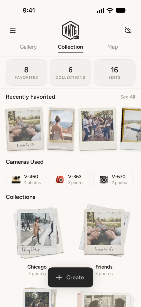
Collection
And every trip in its own collection
Group your prints into collections like Chicago or Friends, and find your favorites and the cameras you use most on one tab.
More about CollectionQuestions
What people ask before they download.
Is the photo map free?
Yes. The Map tab is free in VNTG, for every photo you finish in the app.
Does it show every photo on my iPhone?
No. It shows the photos you finish in VNTG, so the map reads like a travel journal of your prints, not your whole camera roll.
What if a photo has no location?
VNTG uses the location saved with the photo, or the place name when that is all there is. A photo with neither stays in your gallery and simply is not pinned.
How do I see it in 3D?
Switch the map to Satellite, then press and hold a photo. The map flies over that place in 3D where Apple has 3D map data for it.
 Free on iPhone
Start your map with one photo.
VNTG is free to download, and the map comes with it.

4.7 from 39,000+ ratings